
In late October, the DC Council marked-up the Safe Streets for Students bill, B24-0066. It would create an office of safe passage to monitor conditions and promote safe passage; provide for more crossing guards; and ensure a master plan for safe routes and passage for school kids over 5 years. A vote is expected before the end of the year.
As a way to make DC school transit safer, the legislation is an improvement over the status quo.
But that’s not a high bar, as the status quo is basically a longstanding municipal horror.
Consider what Ward 4 council member Janeese Lewis George noted in December 2021:
“More DC residents were killed in traffic collisions during 2021 than during any year since 2008. Those lost to traffic violence this year include 4-year-old Zyaire Joshua in Ward 4 and 5-year old Allison Hart in Ward 5, both of whom were killed less than a quarter mile from a District school. . . . [and] 9-year old Kaidyn Green in Ward 8 and 9-year-old Pete Dzeikan in Ward 7 were both struck by drivers within an hour of each other while leaving school.”
The committee report for the Safe Streets for Students bill notes problems with getting enough crossing guards; poor addressing of traffic violence around schools by our DC department of transportation (DDOT); safe passage problems (i.e., students facing violence and feeling unsafe on the way to/from school); and safe passage programs administered by the deputy mayor for education (DME) that don’t appear to have much commitment and action from the DME.
The bill comes literally years after a November 25, 2019 hearing for a very similar bill that never got voted on. At that 2019 hearing, public witnesses noted these needs:
–More crossing guards at and near schools, especially at known dangerous intersections
–More traffic calming at schools, especially with known dangerous intersections
–More marked cross walks near schools and commuting routes to schools
–Better protection of pedestrians at cross walks near schools
–Better traffic enforcement at high-speed, multilane roads
–Better treatment of students by Metro police
–Focused and dependable transit services for homeless students
–Increased frequency of Metro buses during school arrival and departure times
–Reduced congregation of students at transit hubs.
Years later, on March 14, 2022, a hearing was held on two other bills addressing safe passage and routes by mandating infrastructure changes around schools (Safe Routes to School and Walk Without Worry). In that March 2022 hearing, public witnesses raised problems of schools without accessible bus routes; no nearby metro; and lack of school signage, crossing guards, and marked crosswalks.
(Sound familiar?)
Indeed, this summary of the Safe Routes to School bill (from its introduction by Janeese Lewis George and also quoted above) reads like the answering of a years-long wish list of DC school advocates:
“requires a traffic signal or all-way stop at every local intersection within a quarter mile of a school . . . mandates raised crosswalks and curb extensions at every intersection adjacent to a school – as well as crosswalk warning pylons, flashing pedestrian signs, and speed humps near school entrances . . . improves student safety by banning parking within a school’s designated pick-up or drop-off zone . . . expands school zones to cover 150 yards around a school facility and activates the reduced speed limit in school zones to seven days a week. . . . requires an Automated Traffic Enforcement camera within each school zone. . . . requires that DDOT upgrade traffic safety infrastructure at every school zone and quarter-mile perimeter within two years of the law going into effect. Because past traffic installations have been inequitable, the legislation directs DDOT to prioritize schools that are most at risk of traffic harm and schools that serve a majority of students whose families earn low incomes. To increase transparency, ensure accountability, and advance the District’s sustainability goals, the Safe Routes to School Act also requires data collection and reporting on student and staff travel modes, crossing guard deployments, traffic control officers, traffic safety investigations, and outstanding work orders in school zones.”
Naturally, nothing happened with the Safe Routes to School bill.
The current bill (Safe Streets for Students) is mainly a reincarnation of the 2019 bill by way of yet another bill, the Safe Passage Expansion Act, which was introduced by at large council member Christina Henderson in February 2021 and had a hearing in October 2021.
Like its 2019 predecessor, the Safe Passage Expansion Act called for an office of safe passage. As p. 7 of the committee report for the current legislation (Safe Streets for Students) notes, the office of safe passage would be responsible “for ensuring the safe passage of students traveling to and from school from 7:00 am through 7:00 pm on days that school is in session. The legislation as introduced also codifies the process by which the new office is to issue grants to Safe Blocks program CBOs [community-based organizations], and sets standards for selected CBOs and safe passage personnel. Finally, the legislation requires that the Mayor run a shuttle bus between the nearest metro station and the DCPS and charter school within each priority area served by the fewest public transportation options.”
Somewhere along the line, the idea of safe passage expanded from the Henderson bill’s original statement of purpose—to ensure safety of students from violent crime, including gun violence, both before and after school—to traffic issues and the violence inherent in poor road infrastructure.
As a result, the current bill (Safe Streets for Students) also takes in parts of the Safe Routes to School bill (which had no action after its hearing) to expand school zones—albeit not as much as the original bill would have (i.e., not a quarter mile, but just 350 feet), while most of the basic infrastructure the original legislation mandated for every DC school (curb extensions, marked and raised crosswalks, flashing signage) are left entirely at the discretion of agencies that right now could easily and efficiently make those improvements and have not been doing so at all in some places, poorly in others, and often wildly inequitably.
The current bill (Safe Streets for Students) also has a remarkably complex set of procedures for DDOT and other agencies (see p. 23 of the committee report) to go through with council approval–which is rather stunning, given that the DC Council has literally taken years to get to this point with just one bill to improve safe passage and routes to school.
While one can joke about doing the same thing repeatedly and expecting different results, the reality remains not merely that DC students are constantly endangered to and from school each day, but that every hearing has the same message from public witnesses, which is that it’s all terrible. (See, for instance, the frightening testimony for the Safe Passage Expansion Act, Henderson’s 2021 bill.) The current bill (Safe Streets for Students) addresses this constant terror at best obliquely, by creating offices of yet more people to be held accountable by the very people who right now are not ensuring safe passage for all.
As it is, anyone purporting to help with safe passage would immediately address the crisis that many DC school kids are facing with the poor distribution of Kids Ride Free cards, which is longstanding, as well as the transit agency’s inability to simply let kids ride free whether they have their cards or not. The current bill (Safe Streets for Students) doesn’t address any of that.
And incredibly, the current bill’s fiscal impact statement shows that DC cannot fund it, mainly because it’s very expensive to create new offices and hire personnel to run them.
But school zone signs are not expensive—nor is it expensive to get existing agencies to put up those signs, which as far as I know is their legal duty.
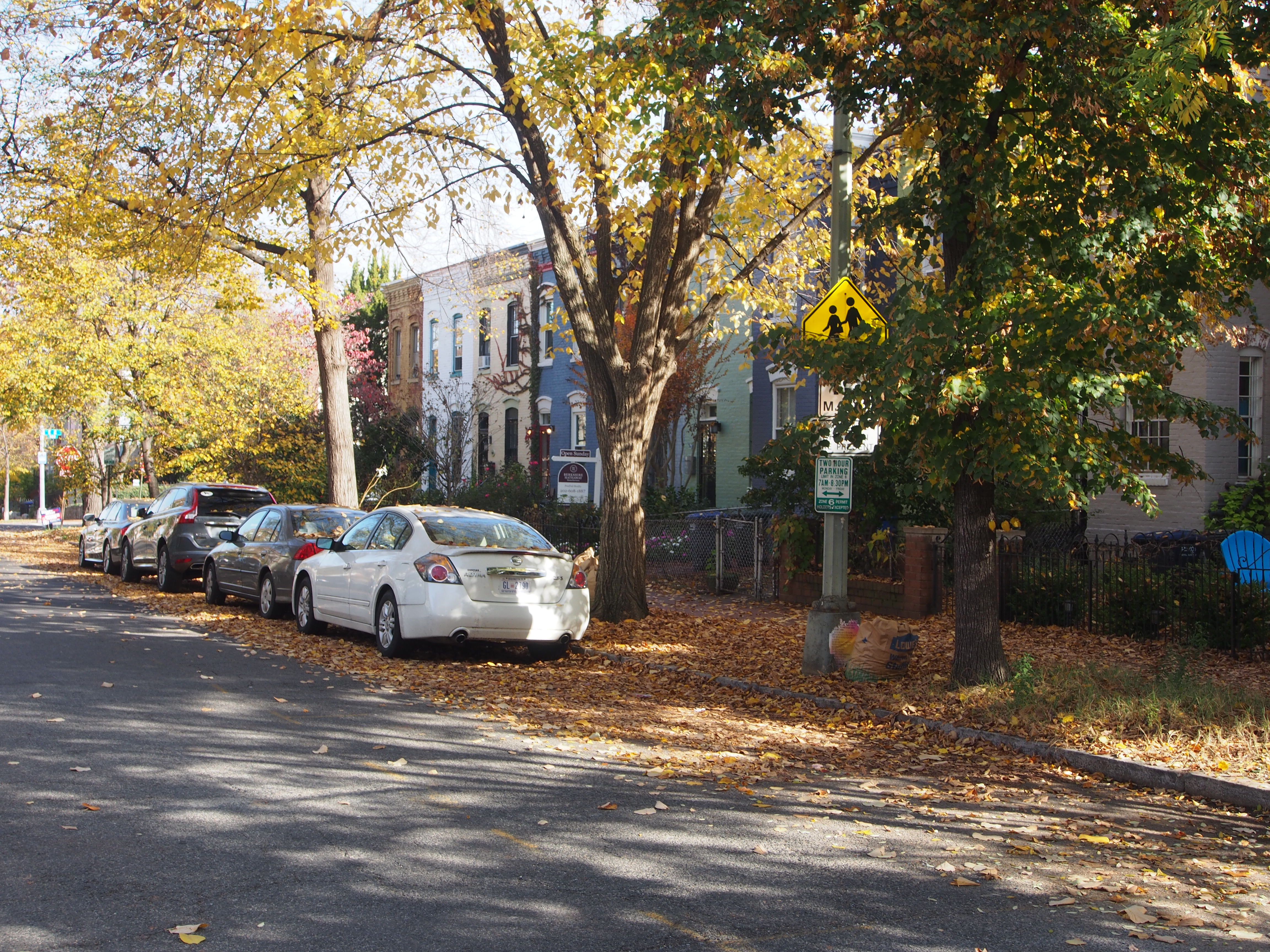
To illustrate just how far short something as simple and relatively inexpensive as our school signage falls right now, I have put below photos I took last week of school signage around just three DCPS schools on Capitol Hill: Peabody (built 1880), Stuart-Hobson (built 1927); and Watkins (built 1962).
These three schools together comprise the Capitol Hill Cluster School, which educates more than 1000 students from preK3 through grade 8 in three separate school buildings in the neighborhood of Capitol Hill. Because the school buildings are separated from one another by many blocks, the Cluster’s boundary is one of the largest in DC. Among other things, it means that a 4-year-old in bounds for her seat of right at Peabody may have to commute 1.5 miles one way each day.
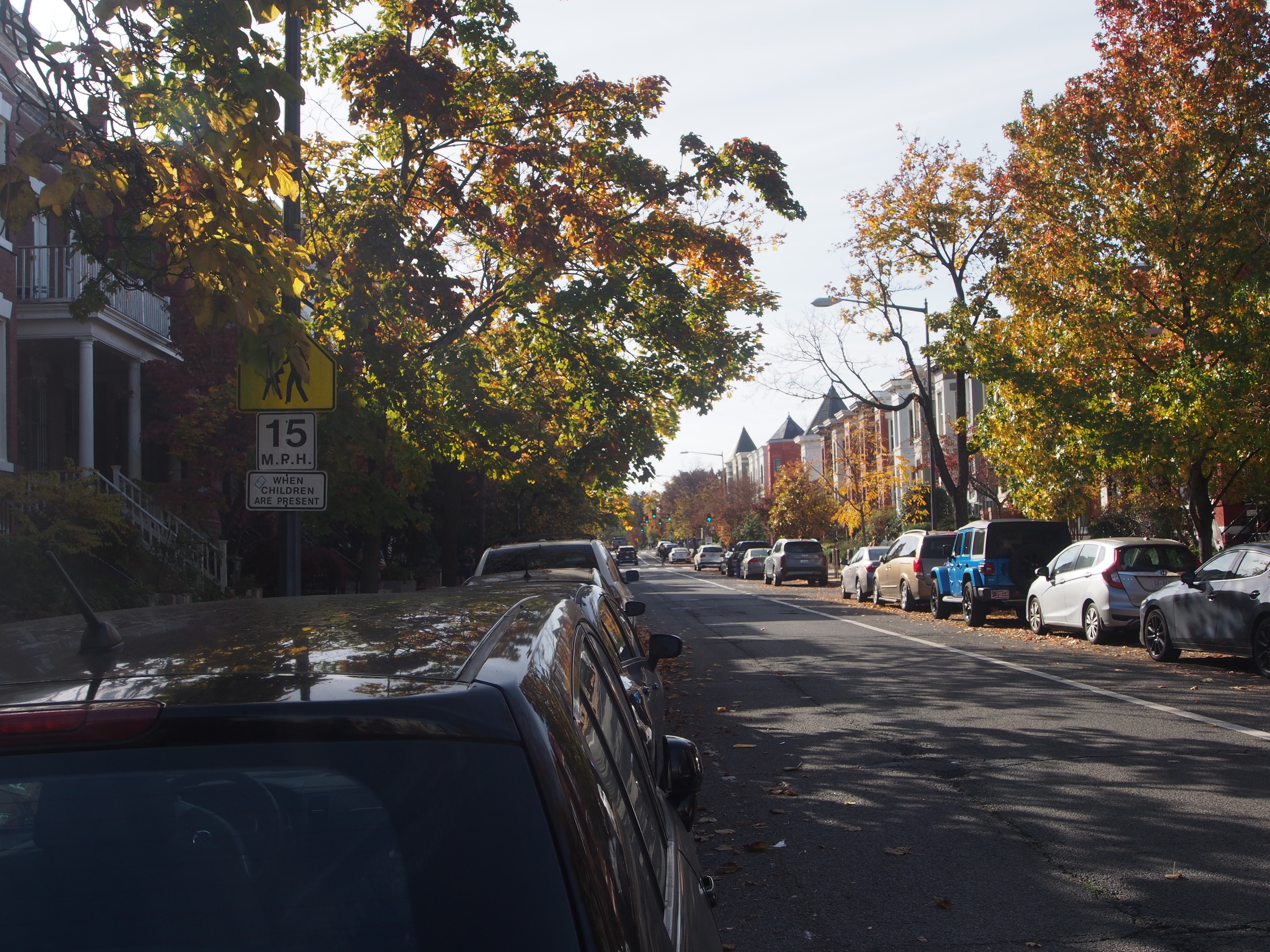
The areas around these schools are notable for several features: lots of rowhouses; multilane roads heavily used by commuters either right next to or within a block or two of the schools; and, when it exists at all, conflicting and poor school signage.
All of that is also typical of the areas around other Capitol Hill public schools, many of which, like the Cluster campuses, have been educating students in their current locations for the better part of a century (or more!).
In other words, no one currently in DC can say that any of these schools is unexpected. And the problems of safe passage in the neighborhood, like those elsewhere in DC, are constant, multifactorial, and mostly not tackled directly by the current legislation. Those problems include missing crossing guards, high traffic burdens, and no universally applied infrastructural safeguards, even ones as simple and inexpensive as signs.
Recently at Miner Elementary (a Capitol Hill school two blocks from the busy (and massive) intersection of H, Florida, Benning, Maryland, and Bladensburg roads), a missing crossing guard prompted the principal to go out and direct traffic.
While that principal’s solution appeared creative, it is also a reminder that we don’t need studies or new offices, but elected and appointed officials to use current and future resources much, much better to ensure safe passage everywhere in our city.

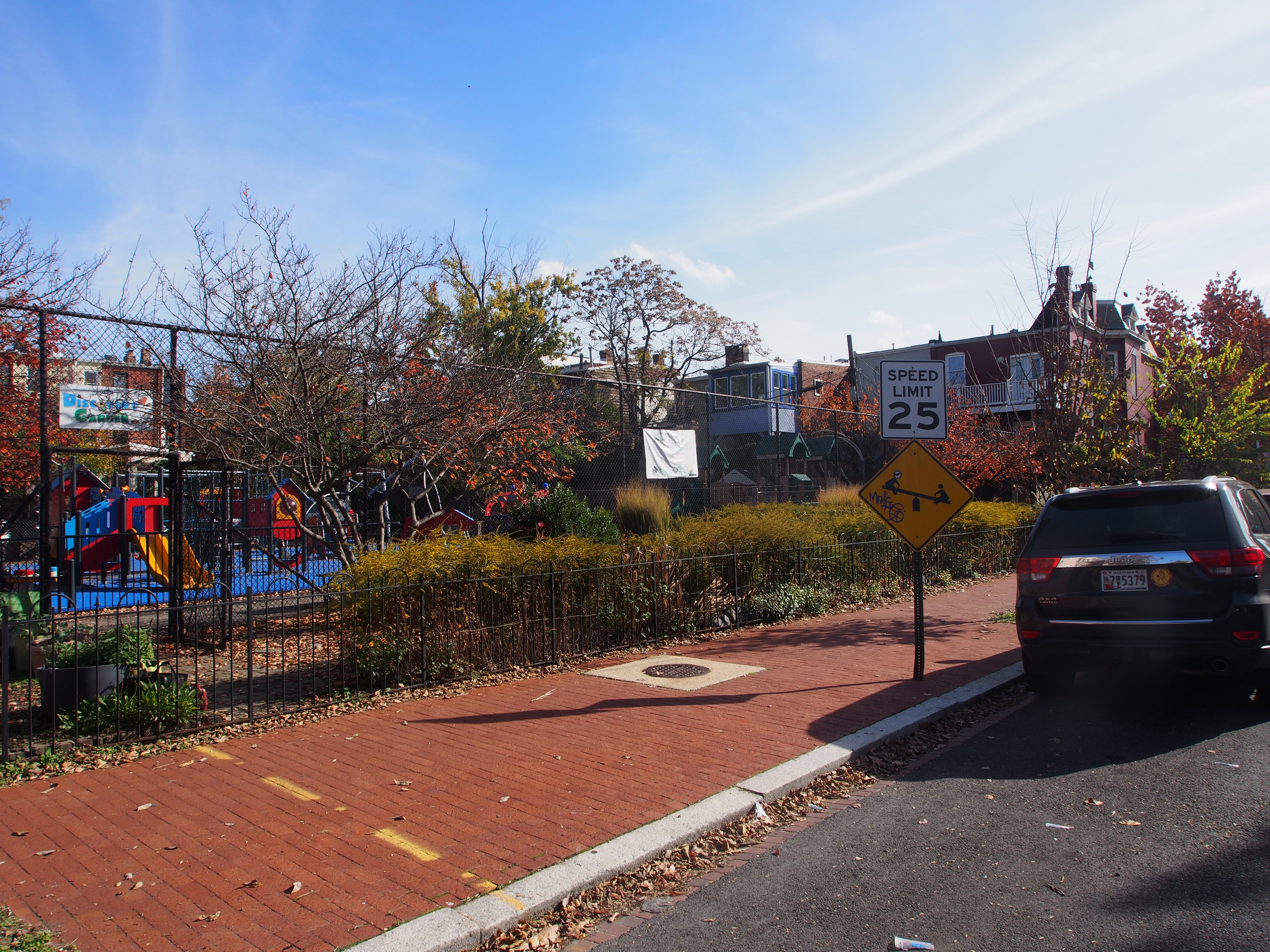
This sign is on the 500 block of F Street NE. If you look closely at the middle of the picture, you will see a dark wall by the road. That is a retaining wall at the back side of Stuart-Hobson Middle School. The school occupies an entire city block, between E and F and 4th and 5th streets NE. But I found no sign like this anywhere on the block occupied by the school. The only signs I found to indicate that there was a school there at all were in surrounding blocks. There are also no speed humps or other traffic-calming measures in those surrounding blocks of the school.

This is the 300 block of E Street NE. Stuart-Hobson is at the top left. The sign to indicate the school is nearby is obscured by trees.

This is the 300 block of F Street NE. You cannot see anything of Stuart-Hobson from this vantage point. For nearly 100 years, Stuart-Hobson has existed as a public school in the next city block. The sign itself has no flashing light, despite saying it does.
This is the 400 block of 5th Street NE, less than a block from Stuart-Hobson. There is a school zone sign in this picture, but it is obscured to all who pass by it during months when trees have leaves.
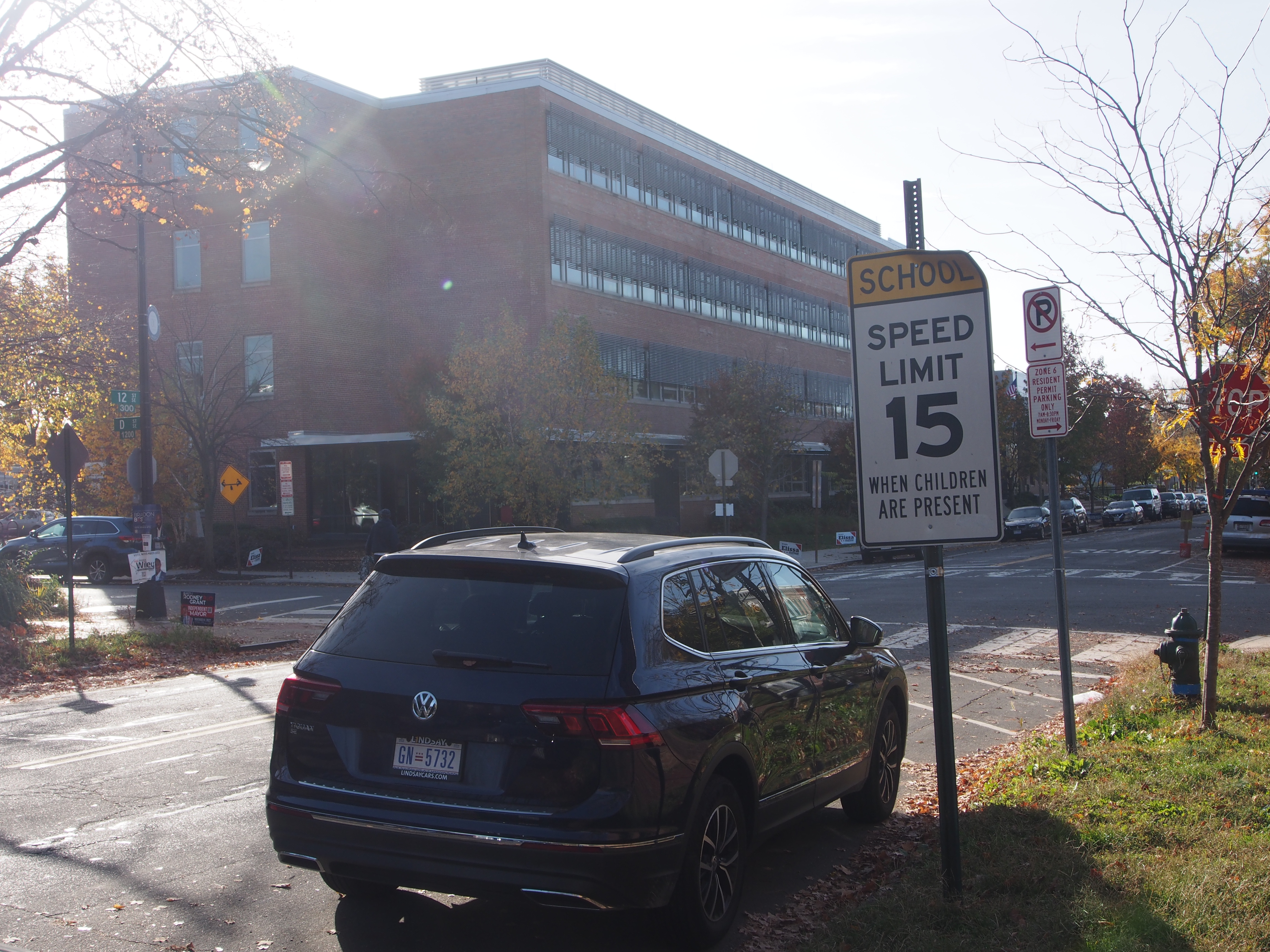
This is on 4th Street NE, right next to Stuart-Hobson MS. Note the 25 mph sign to the left literally next to the school. I have regularly observed cars speeding down this block from busy H Street, just 2 blocks away. There are no signs on the entire city block occupied by Stuart-Hobson to indicate that there is a school there, much less for cars to slow down around it. Stuart-Hobson was renovated less than a decade ago, while the speed signage around it does not appear to have been touched in that time.
This is the 400 block of 4th Street NE; note the school zone sign to the left, a block away from the 25 mph sign in the preceding picture. If you are driving past this sign, you have already passed Stuart-Hobson (potentially going 25 mph per the preceding photo!). But there’s another school a few blocks down 4th Street: Peabody. So maybe this sign is to indicate that? Let us travel on down 4th Street.

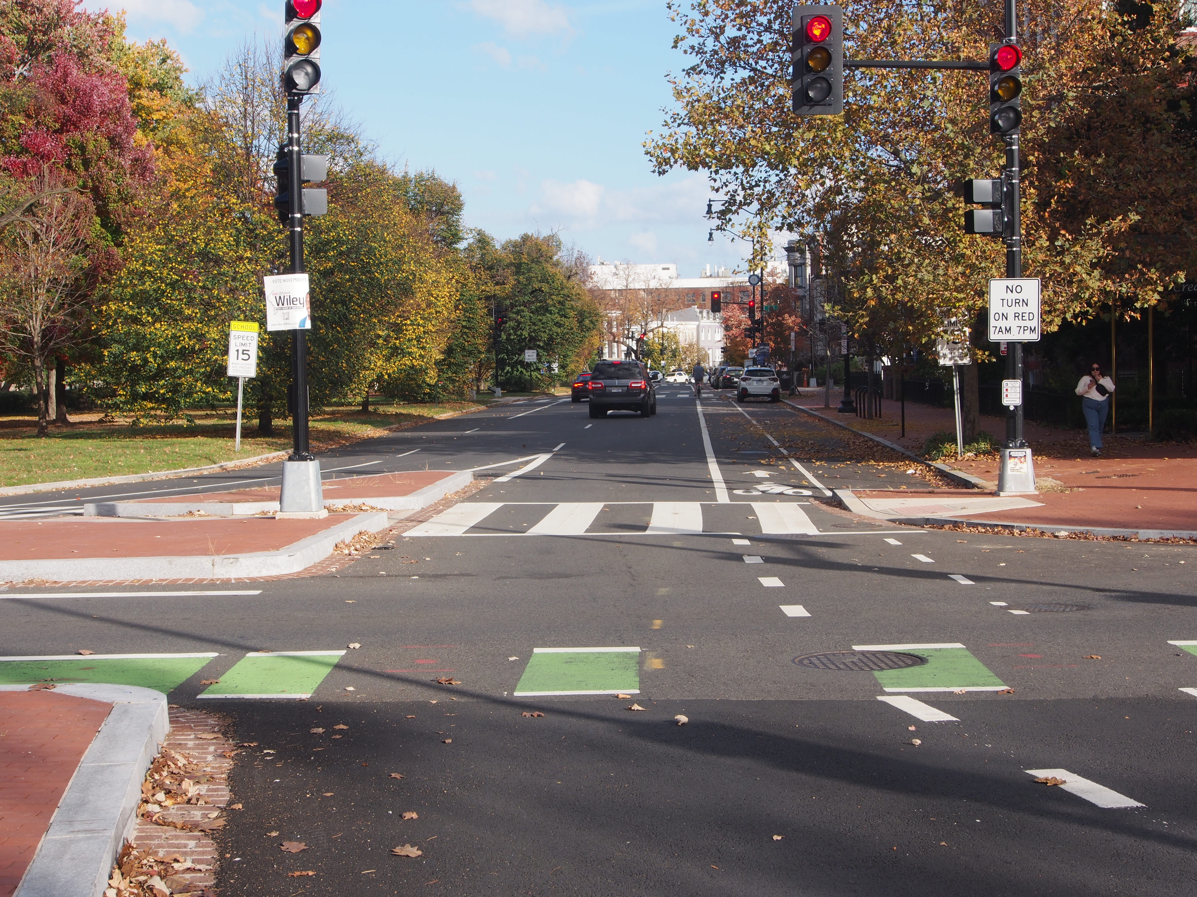
A few blocks from Stuart-Hobson, this is the view from the west side of 4th Street NE, looking toward Peabody. (Yes, there’s a school there. No, you cannot see it.) This intersection was recently reworked by DDOT to provide pedestrian buffers for the large sea of asphalt that marks the intersection of diagonal Massachusetts Ave. with Stanton Park and 4th Street NE. In that reworking, DDOT provided no signage in the intersection to indicate a school was there. As a major east-west route, Massachusetts Ave. on Capitol Hill is a multilane commuter thoroughfare that winds directly past Peabody, which has been a public school in that location for more than 140 years.

Here we are, a block from the preceding photo, at the confluence of Massachusetts Ave. and Maryland Ave. NE at 4th Street and Stanton Park, looking east. Peabody is on the right. That school sign to the left is the first indication to anyone driving from the north that there is a school there. Given the high volume of traffic during rush hours; the curve; the multiple lanes; and the fact that two roads are coming into this intersection, there is little to no chance that drivers from either 4th Street or Massachusetts Ave. headed to the east will see the school until they are, literally, right in front of it. There are also no speed humps or other traffic-calming measures on roads around the school. For decades, Peabody has served preK3 through kindergarten age children.
This is a view of the same intersection as in the preceding photo, but from the vantage point of Maryland Ave. NE headed east. The school zone sign to the left is visible. The school zone sign to the right, by the person walking on the sidewalk, is obscured by a tree and is not visible to any drivers from any direction until the tree loses its leaves. Like the intersection two pictures before, this was recently reworked by DDOT to provide pedestrian buffers–but no updated signage was provided to indicate a school was there.
Back on 4th Street again, this is what drivers see as they pass the Peabody school playground: a sign indicating 25 mph. The playground for Peabody is only ever used for students of the school; yet, the see-saw sign would suggest it’s a public park, not a school. Also, there is no sign on this block; on the 400 block of Constitution (which is where the front of the houses at the top this picture face); or on the 200 block of 5th Street NE (which is where the front of the houses on the left of this picture face) to indicate a school is here. There are also no speed humps or other traffic-calming measures on those roads. Constitution Ave. is a major east-west commuter thoroughfare.

This sign is on the northeast side of Stanton Park, at the intersection of 6th Street NE and Maryland Ave. NE. While it is visible to cars traveling west along Maryland Ave., the Peabody school itself is across the park and not easily (or at all) visible. This is literally the only sign a driver might see of a school nearby until they go around the park and see the sign in the second preceding picture. Even then, if the driver is proceeding down 4th Street and not turning around the park, the only sign they will see to indicate speed is the one in the immediately preceding picture, showing 25 mph right next to the school itself.
This is one of several school zone signs I found around Watkins Elementary. The school is home to a co-located recreation center, which may account for the see-saw sign on the middle left of this picture.

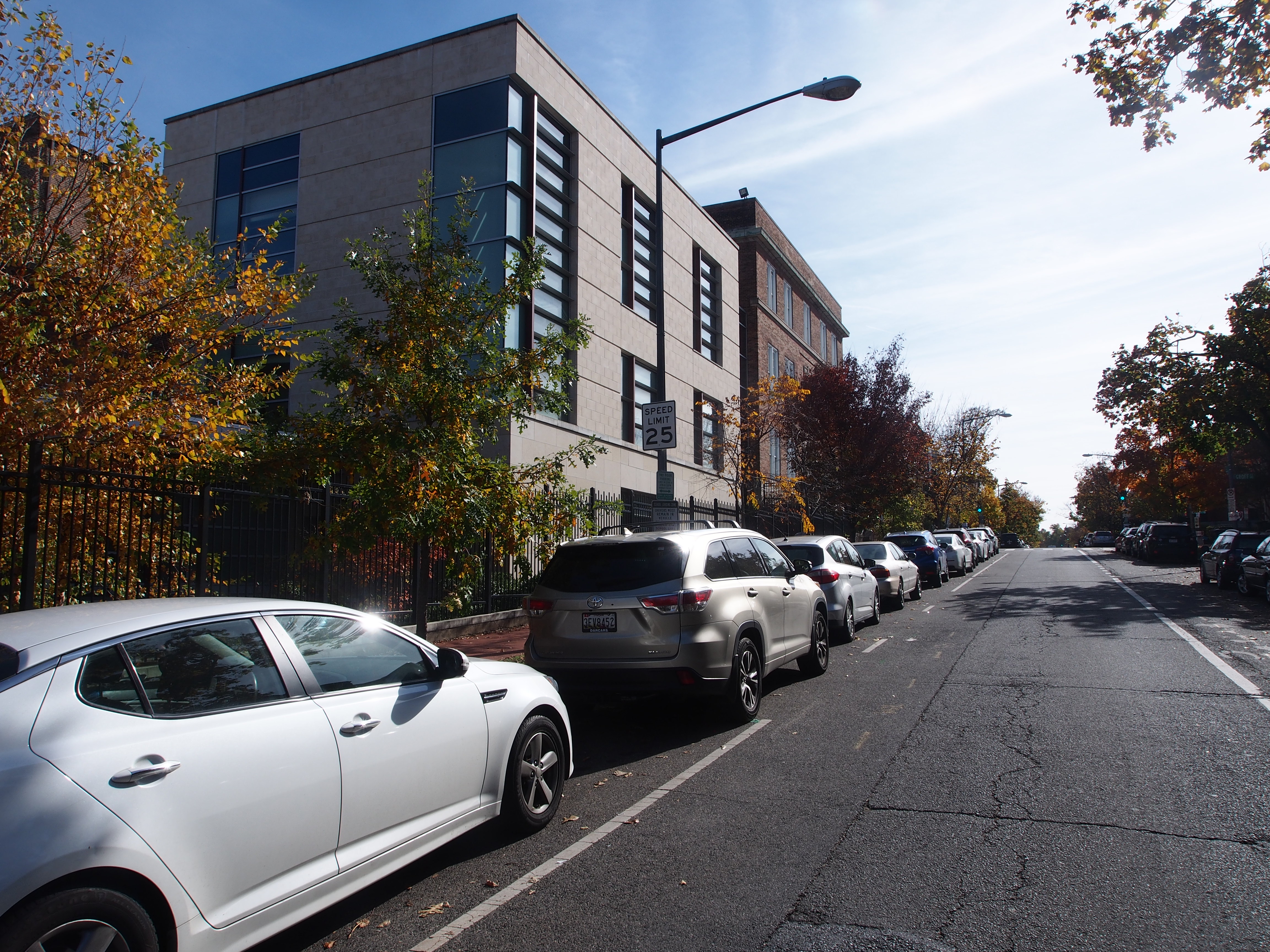
Watkins occupies an entire city block between D and E and 12th and 13th streets SE. This is the south side of the Watkins block, about 200 feet from Pennsylvania Ave. SE, which is a major, multilane commuter thoroughfare. The surrounding residential streets around Watkins have relatively new speed humps. For each speed hump, there are two signs, one in either direction, to indicate that the hump is there. As a result, there are many times more signs to warn drivers of speed humps than signs to tell drivers to slow down because there is a school. Thus, we can see how DC actors recently used city resources to prioritize driver comfort over school and child safety.
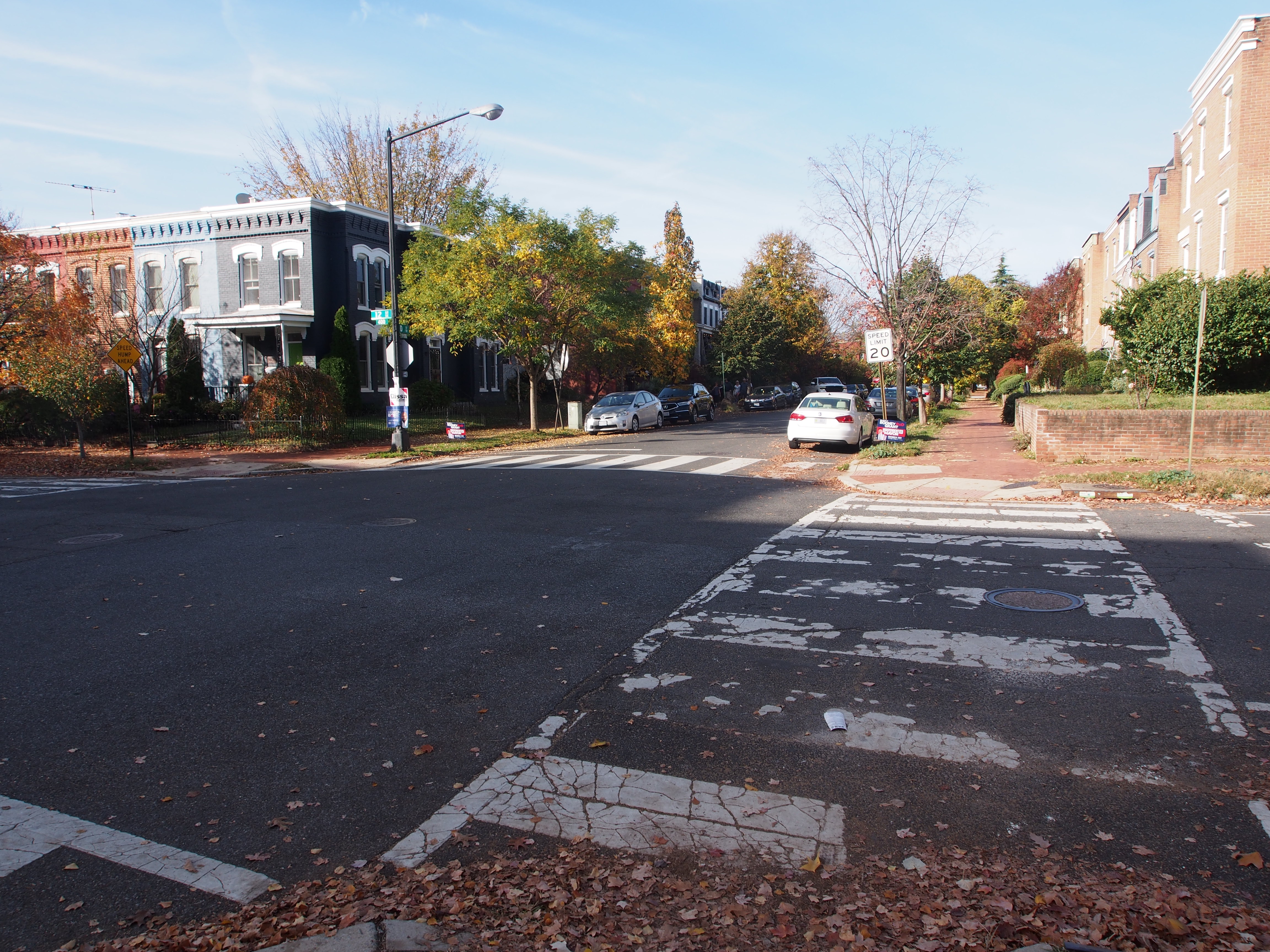
This is D Street SE, at the northeast corner of 12th, looking west. The city block occupied by Watkins is to the left, outside the picture. Note the 20 mph sign–for the next block, which is where D meets 11th Street, another major commuter thoroughfare that has, just a few blocks from here, multiple public schools along it, along with multiple near misses for students.
